Mountain Bike Trails - Dordogne
- Blog

Day 1
Mountain-biking trails through the Dordogne with Tom Redfern, founder of Broken Riders
Exploring
Fortunately for me, although some may disagree, I'm not a wild boar. I ended my brief, if exciting, ride down what looked like promising singletrack to be met with yet another boar huntsman’s hide. I could certainly empathise with the wild beasts. After you come down the track, the hide leaves you with nowhere to run (or cycle). Your only option is to turn around and grind back up towards the road. So I dodged the imaginary lead shot heading my way and began pedalling back.
This is how it is when you mountain bike in the Dordogne, France. It's a mixture of ecstasy as you find the sweetest piece of natural, forest singletrack and utter frustration as it abruptly ends for no reason other than the hunters thought that this would be a great location at which to have a go at ending the life of some poor, unfortunate creature.
My riding adventures were part of a family holiday to the Dordogne and so choosing the location was always going to be a compromise of some sort. It had to be an area with accommodation, it had to have appeal for the kids (note: swimming pool required) and it really ought to be beautiful scenery - preferably with hills, lots of hills. The last of those three requirements was of course my own.

Green Perigord
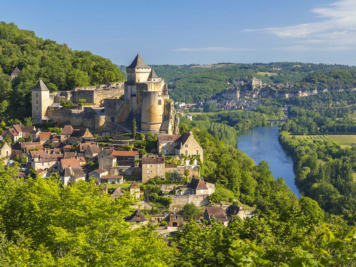
Settling on a rented gite in a village called Bourdeilles in the Périgord Vert" (Green Périgord) region of northern Dordogne as the first part of our holiday, my initial thoughts were that "it's a bit flat". However, once I actually got hold of a map (the blue Carte de Randonnée 1934O), things began to look up. Laying the map flat out on the table, I spotted little paths everywhere and although there was certainly no great height to be dealt with, some of the contours looked nicely packed together.
Eager to go, my first ride was a real exploration of the local area. Setting off from our accommodation, I took one of the white, dusty farm tracks which run along the ridge from the south west of Bourdeilles to Valeuil. Pretty soon noticing a promising track off to my right, I dropped in, to be greeted by a decent little section of trail that descended into the valley below. Although a natural trail, I found lots of elements to boost off and get some air. The holiday had begun!
Once at the bottom of the valley, the trail snaked its way back up the other side, pushing its way steeply through a copse to the top of the hill. As I reached the copse, a mass of butterflies flew up in my face. There were hundreds of the things, flapping in front of my face and making me feel like I was a character in a fairy tale. However, the curse of the 'wicked witch' soon appeared. My chain broke about ten metres further up the trail. Not sure why, but one of the pins had sheared clean through. After a bit of cursing, the chain splitter on my multi-tool did the job and I was back in action. Unbelievably, this was to be my only mechanical of the whole three weeks.
Pretty soon after the trail ended and I burst out onto a tarmac road. Several promising paths leading into the forest resulted in cursing from myself as I dived in and then had to pedal back up the steep hill - they just ended, not going anywhere. With the forest being too thick to make my way through, I had no option but to head back up towards the road and try another option. Frustrated and knackered, I headed back to the gite.
Day 2 - South Towards Bussac
The next day I headed out in the opposite direction, south towards Bussac. Within two minutes I found a trail marked by the welcoming yellow marks of the GRP network. Covering over 25,000 miles across France, these trails are local area networks (unlike the red and white marked trails of the long distance GR network). A short, steep climb bordered by fields of sunflowers put me on top of the ridge, with a great vantage point from which to assess where I should go next. I settled for a section of double track that lead off to my left and into the forest. Suitably ragged, it provided a great bit of fun... until it ended at what can only be described as a hunter's watchtower. This homemade structure towered about ten metres and must have presumably been made by local hunters so that they could spot and blast their prey in the dense forest. I was becoming despondent as every decent trail ended all too quickly.
Making my way back up to the top, I spotted a clearing in the forest that looked like a footpath. Guided by desperation to find somewhere decent to descend at speed, I pushed my bars in the direction of the clearing. After only a few metres, the footpath widened to that of a regular bike-friendly trail, becoming steeper and steeper. I grinned at finally having found some challenging trail. As my speed increased, so did the technical challenges I faced. Natural steps in the trail, caused by years of erosion, provided awesome drop-offs to negotiate. It reminded me of the latter sections of White's Level at Afan, although considerably shorter.

All too soon it was over, and I headed back onto the road and towards Bussac. After a brief fuel stop in the village, I picked up the GR36 and moved east towards La Courelie. This was a tough climb, the trail having been weathered by the wet ravages of winter weather and the hot, dry summer. After La Courelie, the trail levelled out a little and once through Le Puy-Mas I was back on the road, but at least I was at the top of the valley. The map came out and looking down I noticed I was standing on a road marking for the route of the Tour de Dordogne, a popular French road race of around 590km which happens every July. As I scoured the landscape for any sign of a trail heading down from the ridge towards Biras, I spotted some power lines running steeply down the side of the hill.

The excitement increased as I headed towards the power lines and spotted a trail opening. Hitting the entry at speed, I was greeted by a soft loamy trail that snaked its way down the steep sided valley through the pine trees. Bouncing off tree roots and boosting off small ramps, my bike ripped down the trail, taking everything in its stride. At the bottom of the trail, a right-handed natural berm enabled me to maintain some speed until the terrain levelled out and back onto the road. Although only just over half a kilometre long, this was definitely the best moment of riding so far. Fork lock-out on, I grunted back up the steep switchback tarmac road to have another go. Two more high speed runs later and heading low on water and energy, I decided to figure out the quickest way to get back to Bourdeilles - but not before having marked the trail on the map and obviously naming it 'Le Powerline'.

Heading north on the road, I hit a crossroads, one branch of which was a track heading in roughly the direction I wanted to go. This seemed like the obvious choice, but given previous experience and my low energy levels, I decided to check on the map before I headed downhill. Sure enough, the map confirmed that the trail ran down the hill to the east and north to the beautiful Chateau de la Cote. It was met by a road which would lead me back to Bourdeilles.
Within a couple of minutes the track ended, my progress halted by a chain-link fence barring entry. Looking around, I saw another, narrower trail to my right. Choosing this and hoping it had the desired location at the other end, I pointed my Stumpjumper down the hill. The trail steepened and pretty soon I was blasting through an oak wood, flying over exposed roots and leaving a trail of dust and flying acorns. At the bottom of the trail I was met with a series of natural whoops (bumps), which I tried to manual and failed to on all but the first. The trail crossed a stream and continued to head north until it met the road which took me back to Bourdeilles. Exhausted, but elated having found some decent trails, I showered, opened a beer and set to work on cooking a rather large dinner on the barbecue for myself and the family to celebrate.
Last Day - Last ride
The following days were spent repeating my new found trails and sessioning the wonderful downhill trails I had found, although all the while conscious that during the previous days' four hour rides I hadn't seen another single person...
For my final ride in the Périgord Vert region, I decided to head to the highest local point, Bourland - although at only 237m, it hardly qualifies as a high peak. My loop this time involved heading east along the ridge as I'd done on the first ride. Continuing on past the trail where I experienced the butterflies, I headed towards Le Baconnet and up through the forest towards La Chauterie via a steep, tough, wooded climb. At La Chauterie, I turned right at a house surrounded by coaches (maybe the owner had a coach hire business?) and hit a nice, long section of farm track heading down the valley towards Chateau La Cote. The dusty trail picked up speed as it headed towards the bottom of the valley, where it carved left. Nature provided a fabulous berm for me to rail and maintain my speed until the trail levelled out and I found myself climbing up the oak wood trail with the whoops. Grinding to the top, I couldn't resist another crack at Le Powerline trail, which was about four hundred metres up the road and would take me down into Biras.

The climb out of Biras was tough, as a worn, rocky technical trail tested my endurance and strength. Once out of Biras I followed the trail to Le Montet, crossing a stream only to be greeted with yet another sharp climb as the trail headed north through some woods. If there were many more climbs like this one I would begin to struggle, as the temperature was soaring to around 32 degrees and I was beginning to boil. Once out of the woods I could see the water tower which marked the highest point and so my mood lifted. However, first I had to cross a steep sided valley, with the trail heading steeply downhill and meandering its way back out towards the hamlet of Bourland.

Once through Bourland I rested at the water tower, contented by the fact that my route back to Bourdeilles was going to be pretty much downhill all the way. I followed an uneventful double track back in the direction of Le Baconnet, making sure to hammer down the trail I'd climbed up a few hours earlier. I hadn't realised how rocky the trail was as it swept to the right and I almost lost the back end of the bike as I skipped from one section to another to avoid a football sized rock. From Le Baconnet it was back onto the tarmac and then up to the ridge track and back to Bourdeilles and an ice cold beer.
To be continued...


